Yosemite to Sequoia and Kings Canyon National Parks Road Trip
If you’re looking for the ultimate way to explore California’s Sierra Nevada Mountains, then a Yosemite to Sequoia National Park road trip is a bucket list adventure.
Also known as the Majestic Mountain Loop, you’ll find yourself wandering among the giant sequoias, winding your way through the vast landscapes of Kings Canyon, then admiring the glacier-carved granite valley of Yosemite National Park.
For the past six years, I’ve guided backpacking and camping trips throughout these parks. Here are some of my favorite spots to explore and all the details you need to plan your Yosemite to Sequoia National Park trip!
What is the distance from Yosemite to Sequoia National Park?
The drive from Sequoia National Park to Yosemite National Park, and vice versa, is about 4 hours. Along the way, you’ll head out of the Sierra and into the city of Fresno, then climb back through the foothills and into Kings Canyon National Park.
How long should I spend exploring Yosemite, Sequoia, and Kings Canyon National Parks?
With a vast amount of terrain to take in, you should spend at least a week on your Majestic Mountain Loop road trip.
Spend at least 3 – 4 days in Yosemite National Park. This gives you the chance to explore beyond the park highlights. Because Yosemite has an extensive road system it offers a variety of front-country access for hiking, scenic drives, and vistas.
Then head over to Sequoia and Kings Canyon National Park. The two parks border each other and operate together as a park unit. Spend at least 3 – 4 days exploring between the two. If you plan to dive into the vast wilderness then give yourself a few extra days for a backpacking trip.
Where should I start my Yosemite to Sequoia National Park road trip?
There are a few major cities with airports near the Sierra Nevada mountains in California. This gives you a few options to start and end your trip.
San Francisco
San Francisco is a great starting point. The drive from San Francisco to Yosemite National Park is only 4 hours. The drive from San Francisco to Sequoia National Park is just over 4 hours. You can easily turn this route into a loop and enjoy different scenery the whole way!
Flights in and out of San Francisco are usually some of the best rates you can find near the parks and there are plenty of rental car options there.
San Francisco to Yosemite and Sequoia Map
Fresno
Fresno is a smaller city located in central California, just outside of the mountains. It’s a convenient point because it’s central to the two parks.
The drive from Fresno to Sequoia National Park and Yosemite is about 2 hours each. However, the two parks are in opposite directions so you’ll pass back through Fresno as you visit each park.
Fresno to Sequoia National Park and Yosemite Map
Los Angeles
LA is a bit further south along the coast of California. While it’s only about a 4-hour drive from Los Angeles to Sequoia National Park, the drive from Los Angeles to Yosemite is about 6 hours.
Los Angeles to Sequoia National Park and Yosemite Map
Are there park entrance fees?
YES! Like most national parks in the US you’ll have to pay the national park entrance fee to enter the parks.
In Yosemite and Sequoia & Kings Canyon, a private vehicle is $35 and a motorcycle is $30, for a week pass. Visiting Yosemite and the combined parks of Sequoia & Kings Canyon will total $70.
A great option when visiting multiple US national parks is the America the Beautiful Pass. It’s $80 for the year and covers your entrance fees into all US national parks and many other federal recreation sites. It’s well worth it if you’re on a national park road trip.
You can purchase an America the Beautiful Pass at any of the park entrance kiosks.
When are the parks open?
All three national parks are open year-round 24 hours a day, 7 days a week, weather permitting.
Check online for the most up-to-date road conditions. Only Yosemite Valley is accessible in the winter months. Tioga Pass Road and Glacier Point Road close in late October to early November and reopen between late May and early July depending on snow conditions. Check Yosemite’s website for the current road status.
Generals Highway is the main route through Sequoia and Kings Canyon National Park. The National Park Service tries to keep this road open as regularly as possible but following large storms it sometimes closes. The roads off of Generals Highway close in the late fall and reopen in the spring, weather permitting. Check online for the most up-to-date road conditions.
Other than that, you can enter the parks through most entrances at any time of day. If you enter when the kiosk booths are closed you might have to pay your entrance fee on your way out.
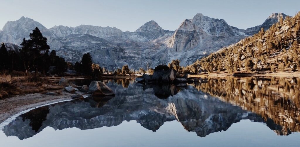
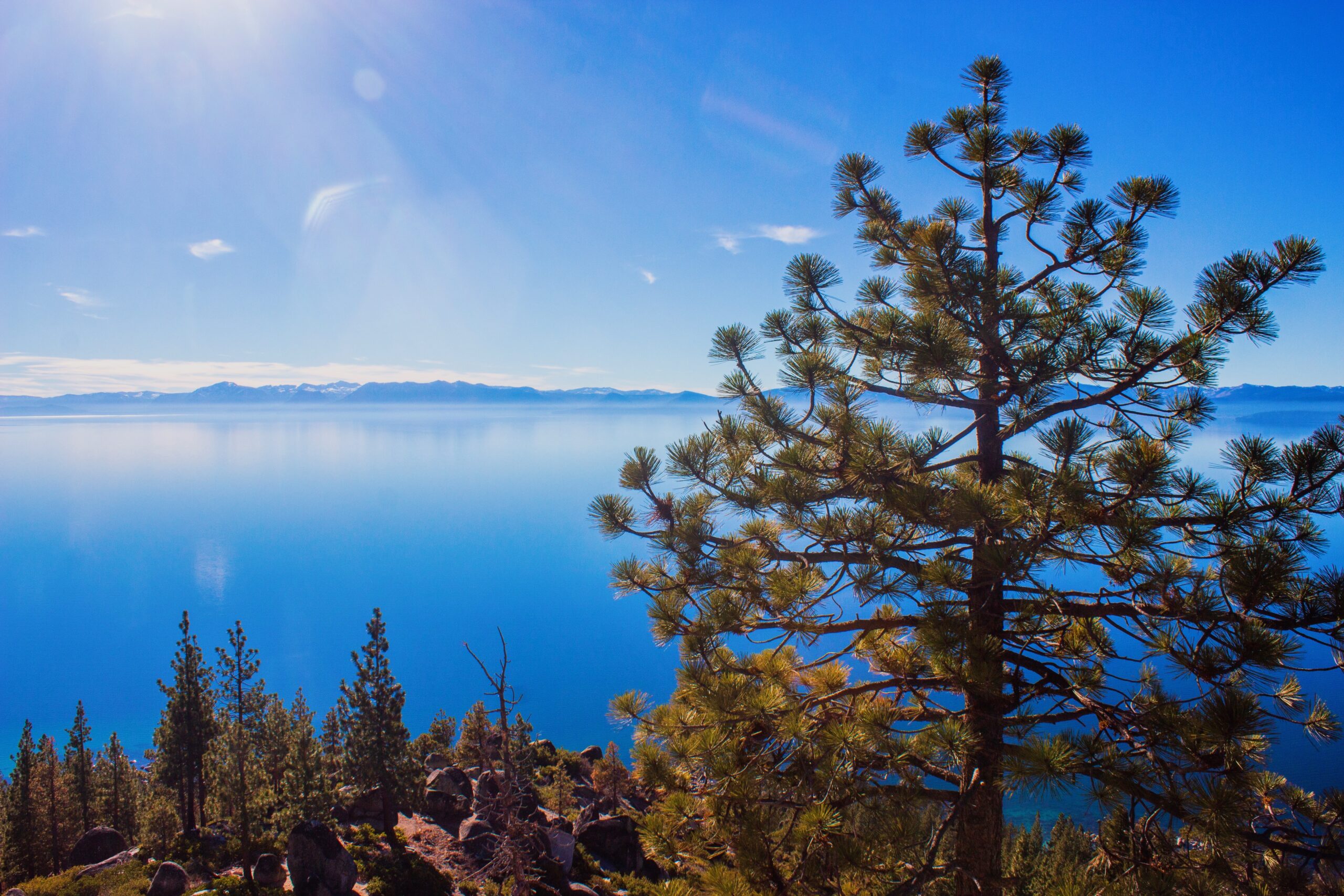
Is it worth adding Lake Tahoe to my itinerary?
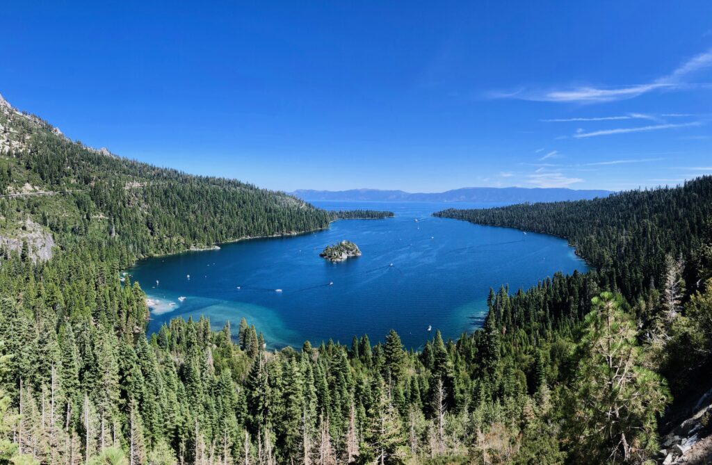
The drive from Yosemite National Park to Lake Tahoe is only about 4 hours. Lake Tahoe is the largest alpine lake in the US. While still part of the Sierra Nevada Mountains, Lake Tahoe’s landscapes are far different from Kings Canyon, Sequoia, and Yosemite.
If you have a few extra days I’d definitely pay a visit to Lake Tahoe!
Can you travel from Yosemite to Sequoia National Park via public transportation?
Unfortunately outside of major cities in the United States public transportation is not as accessible as other parts of the world. While there are ways to take public transportation into the parks during the busy season of summer, it’s challenging. A car is the easiest way to explore the parks.
If you’re heading into Yosemite you can take the YARTS from the cities of Fresno, Merced, Sonora, and Mammoth Lakes. There is a public shuttle bus from Visalia, just outside of Fresno, into Sequoia National Park. These buses run infrequently so book your tickets in advance.
Best time of year for a Majestic Mountain Loop Road Trip
While Kings Canyon, Sequoia, and Yosemite National Parks are beautiful year-round, summer is the most popular time to road trip the Majestic Mountain Loop.
During the summer all park roads are open (weather permitting) which means you can easily drive from Sequoia to Yosemite National Park.
However, summer is also the most crowded time of year. During low snow years, the spring is a great time to drive from Sequoia and Kings Canyon to Yosemite. The fall is also a great option but have a backup plan in case wildfires affect your route.
Yosemite, Sequoia, and Kings Canyon Itinerary
Whether you start your loop in Yosemite or Sequoia National Park, you can check off all the park highlights, and more, if you allow yourself enough time! These are some can’t-miss spots for your Yosemite to Sequoia and Kings Canyon itinerary!
Yosemite National Park
With grand landscapes, roaring waterfalls, and over 750 miles of hiking trails, the list of things to do in Yosemite goes on. The longer you spend here, the more you’ll see but here are a few can’t-miss highlights for your Yosemite to Sequoia National Park road trip.
Snap Photos at Tunnel View
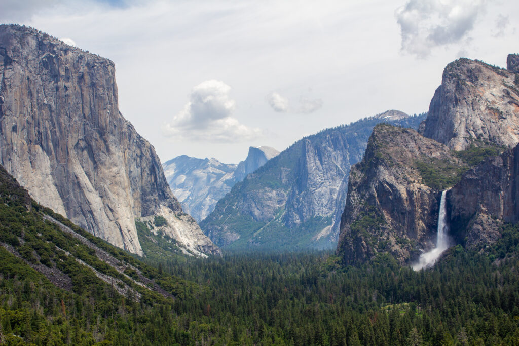
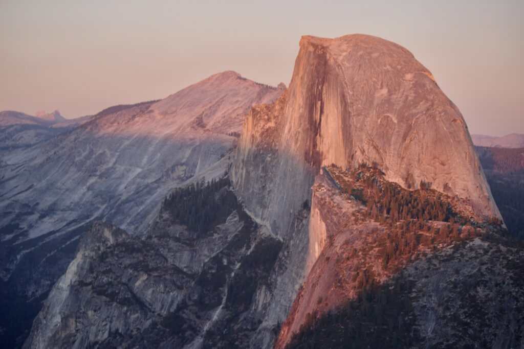
Tunnel View is the most iconic viewpoint in Yosemite National Park. From Tunnel View you’ll see El Capitan, Bridalveil Falls, Half Dome, Clouds Rest, the valley floor, and beyond.
Visiting Tunnel View at sunset is even more special. As the sun sets it beautifully lights up Half Dome making it a great photo opportunity.
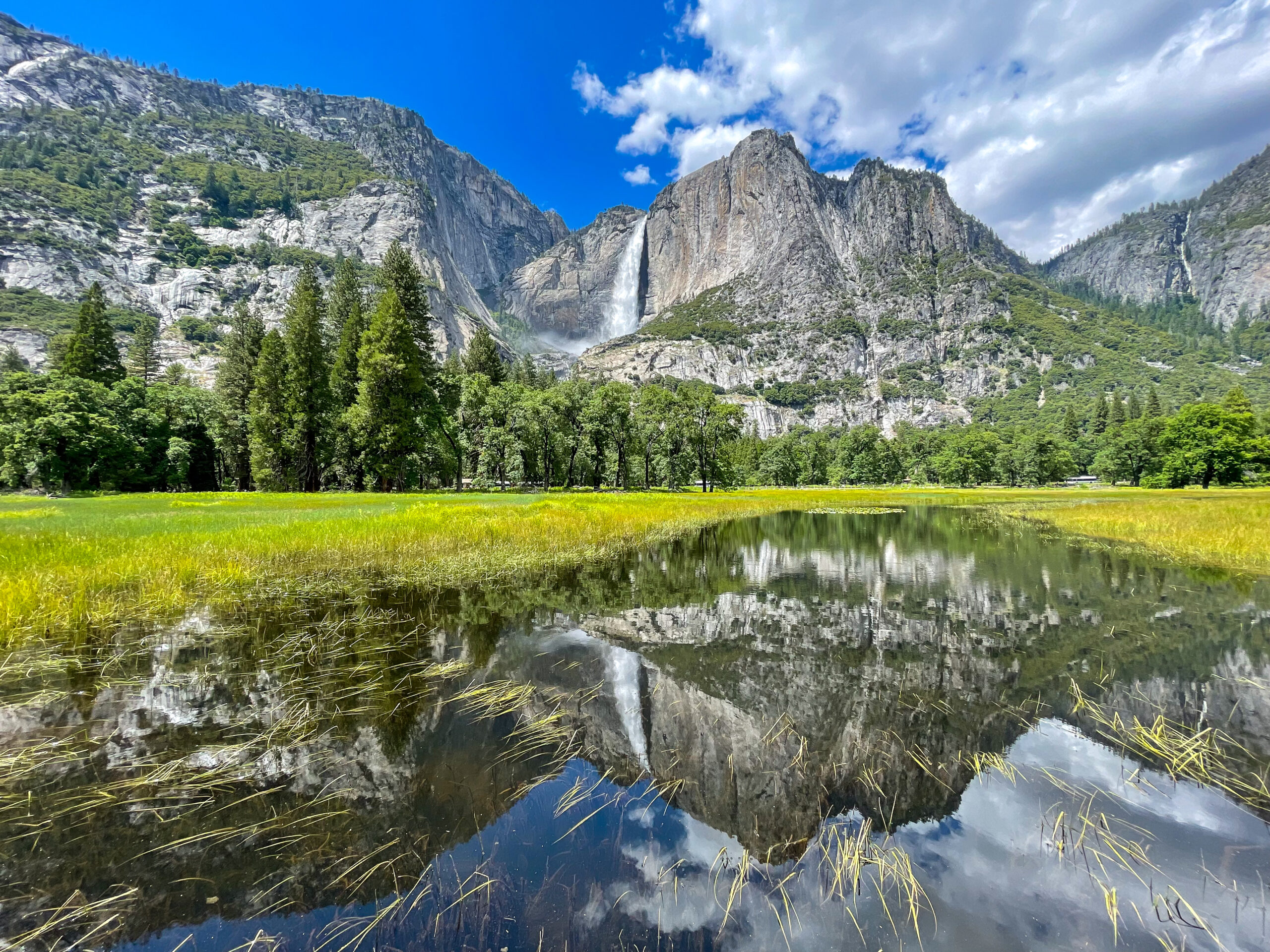
Stand Below Yosemite Falls

Yosemite Falls is the tallest waterfall in North America dropping 2,425 feet. The lowest section, Lower Yosemite Falls, offers a short, paved walk from the trailhead and is well worth the views.
When the Yosemite Falls are flowing at their highest you’ll feel the mist as you approach them. This is most common in the spring. As the season goes on, Yosemite Falls starts to dry up and in low snow years, is dry by August.
Watch Sunset at Glacier Point
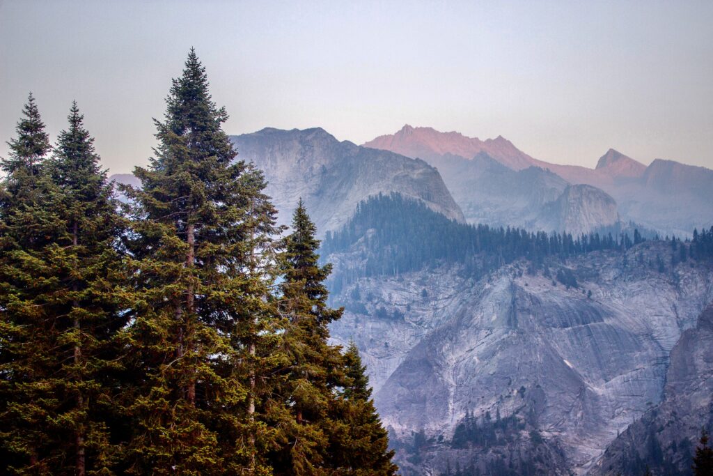
Glacier Point offers the most expansive drive-up viewpoint in Yosemite National Park. From Glacier Point, you can see about one-third of Yosemite. Glacier Point gets its name because glaciers used to fill the landscape from the lookout down to the valley floor!
From Glacier Point, you’ll see some of the most picturesque views of Half Dome, Nevada Falls, Vernal Falls, Yosemite Falls, Mount Hoffman (the geological center of Yosemite), and many other high peaks and domes in the park.
Drive Tioga Road
Tioga Road winds through Yosemite’s high country up to Tioga Pass, sitting at 9,943 feet, the highest mountain pass in California.
Along the way, make sure you stop at Olmsted Point, Tioga Lake, and Tuolumne Meadows to take in the impressive sites of the high country. Also, it’s worth heading all the way down to Mono Lake to see the alpine saline lake from the east side of the Sierra Nevada. This is also a popular way to reach Mammoth Lakes from Yosemite National Park.
Hike the Mist Trail
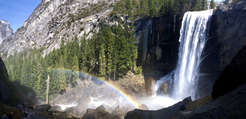
The Mist Trail is one of the most popular hikes in Yosemite. It gets its name from the mist that can potentially drench you on your way up Vernal Falls and Nevada Falls. Bring a rain jacket during the cool months or embrace the shower during the heat of summer!
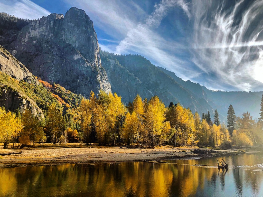
The Mist Trail starts as a paved path, but it still has steep sections before reaching the base of Vernal Falls. Then the trail quickly turns into blocky steps as you ascend alongside Vernal Falls. When you reach the top of Vernal Falls, continue to the top of Nevada Falls. From the top of Nevada Falls, you’ll look out into the start of Yosemite Valley.
Hang Out at El Cap Meadows
“Have you seen Free Solo?!” Yes, El Capitan is where many climbing documentaries, including Free Solo, were shot. From El Cap Meadows you can see climbers ascending the massive 3,000-foot granite monolith.
Look out for tiny specks of color on the rock to start spotting the climbers on El Cap. Binoculars can help. El Cap Meadows is a great spot to have a picnic and hang out among the grasses. Cathedral Rocks border the south side of El Cap Meadows.
It’s also worth stopping at El Cap Meadows in the evening to take in the starry sky or to see the climbers’ headlamps as they camp on the big wall!
Kings Canyon National Park
The drive from Yosemite to Kings Canyon National Park is about 3 hours. Kings Canyon borders Sequoia National Park so it’s easy to continue your drive into Sequoia. On your way from Yosemite to Kings Canyon you’ll pass through the city of Fresno. Because food and gas are limited and expensive in the parks, Fresno is a great spot to stock up.
Check out Panoramic Point Overlook
Stop by Panoramic Point for grand vistas looking into Kings Canyon National Park. You’ll have sites looking into the start of the deep canyons that Kings Canyon is named after as well as expansive views of the surrounding national forests and Hume Lake.
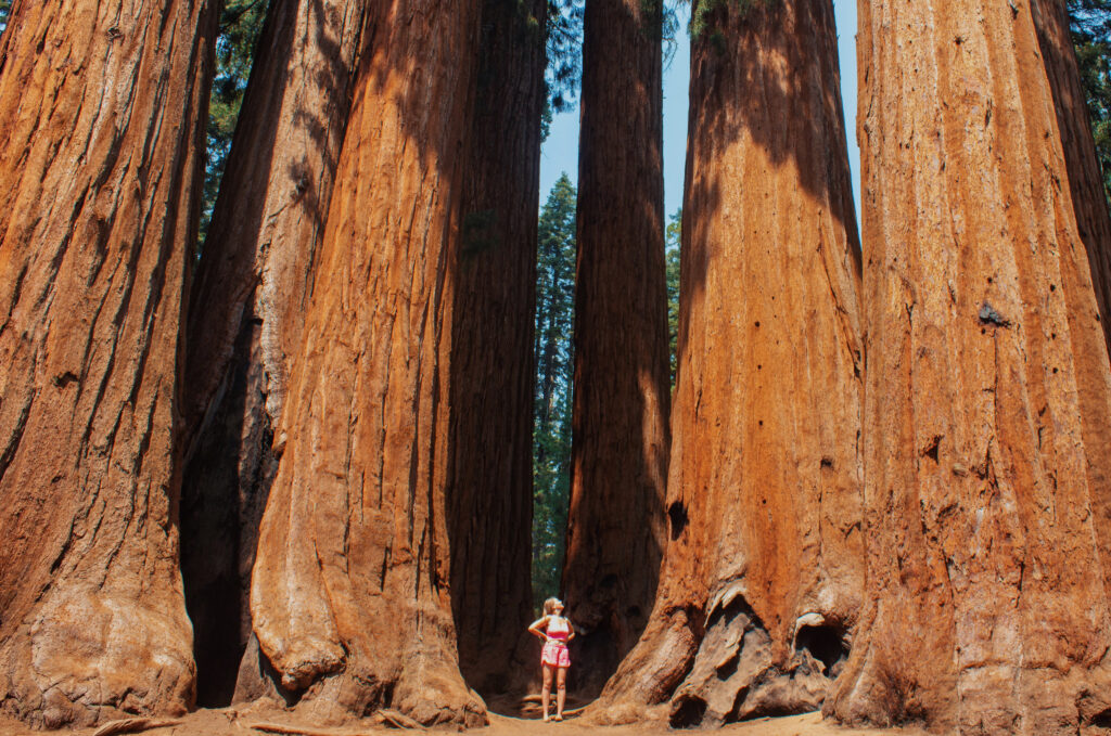
General Grant
Walk the 1/3 mile loop to the General Grant Tree to see many of the famous giant sequoias in Kings Canyon. Along the way are a few other famous trees and features; Centennial Stump, Fallen Monarch, and Gamlin Cabin.
It’s a short and easy walk with many rewarding sites!
Drive the Kings Canyon Scenic Byway
The Kings Canyon Scenic Byway is a must on your Yosemite to Sequoia road trip and it’s the main route into Kings Canyon along the way!
Kings Canyon Scenic Byway starts near the town of Dunlap in the foothills of the Sierra Nevada mountains. From there you wind your way up into the forest over the next 50 miles along Highway 180. Along the way, you’ll pass through Sequoia National Forest, Grant Grove, and Cedar Grove.
Sequoia National Park
The last, or first stop, depending on your route, along your Majestic Mountain Loop road trip is Sequoia National Park!
Like in Kings Canyon, you can see many of the park highlights from Generals Highway or the roads right off of it. Here are some can’t miss hot spots on your way from Sequoia to Yosemite.
Hike Up Moro Rock
Moro Rock is another one of the Sierra’s famous rock dome formations, however, it’s a far more achievable hike than Half Dome. From the parking lot, the trail up to the top of Moro Rock is only 0.6 miles round trip, but it is steep. It gains over 200 feet as you ascend 300 steep blocky steps.
Views atop Moro Rock look out across the dense forest of Sequoia National Park. To the east, you’ll see some of the higher Sierra peaks including rocky ridgelines, more granite domes, and rugged peaks. To the east, beyond the forest, the views descend into the foothills of the Sierra and out into the Central Valley.
It’s generally possible to hike Moro Rock year-round but expect snowy or icy trails if doing so after a snowstorm.
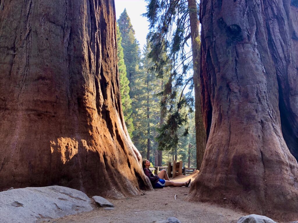
General Sherman Tree
General Sherman Tree is the largest sequoia tree in the world and is considered the largest tree in the world in terms of its cubic volume! It’s also located in a sequoia grove surrounded by many other giant sequoia trees.
The trail to General Sherman starts from the top of the General Sherman Tree parking lot. It’s then a 1.2-mile round trip hike to General Sherman and the surrounding sequoias. The trail descends 200 feet on the way down.
There are handicapped parking spots at the base of the hike, closest to General Sherman Tree. The handicapped parking spots offer wheelchair-accessible access to General Sherman Tree.
Giant Forest Museum
The Giant Forest Museum is located right off Generals Highway in Sequoia National Park. It’s the main visitor center and museum in Sequoia and Kings Canyon National Parks. Learn about the local geography, human history, giant sequoias, and other native flora and fauna at the Giant Forest Museum.
The Giant Forest Museum is also a great starting point to see some highlights including the Giant Forest, Sentinel Tree, and Beetle Rock.
Crystal Cave
Did you know there are at least 240 caves in Sequoia National Park? Crystal Cave is the only one that allows public access and the marble cavern is worth a visit. Join a ranger-led tour to walk the half-mile round-trip loop through the cave to see the fragile stalactite and stalagmite formations.
**Unfortunately, Crystal Cave was closed for the 2023 season due to road damage. The situation is being reassessed in early 2024.
Drive through the Tunnel Log
Sequoia National Park’s Tunnel Log is a can’t miss experience on your Yosemite to Sequoia road trip. In 1937 a large giant sequoia, estimated to have been around 2,000 years old, fell over Crescent Meadow Road. In 1938 it was carved out by the Civilian Conservation Corps so cars could pass through. It’s still a famous site to see today!
The tunnel is 17 feet high and 8 feet wide. If your vehicle doesn’t fit though there is a road to bypass it. It’s worth driving Crescent Meadow Road because many giant sequoias line the road. There are a few pull-offs that make great photo opportunities!

One Comment
Perri Keohane
Thank you for the great information – we’re coming mid-October on our 25th wedding anniversary trip.