Items Similar to Vinland Map and the Tartar Relation
Want more images or videos?
Request additional images or videos from the seller
1 of 11
Vinland Map and the Tartar Relation
About the Item
The Vinland Map and the Tartar Relation. New Haven: Yale University Press, 1965. First edition third printing hardcover with dust jacket. 291 pp. A historical cartography of the Vinland Map which dated to about A.D. 1440, at least fifty years before Columbus landed in the Americas. It is a unique map of the world that shows an outline of the northeast American coast and a legend describing its discovery in about 1000 by Leif Eiriksson, the Norseman from Greenland. After this book was published in 1965 it generated an enormous amount of debate. Chemical analysis of the ink later suggested the map might be a forgery, but recent appraisals of both scientific and humanist evidence argue that it is indeed authentic.
NPT Books, a division of N.P. Trent Antiques, has a large collection of used and out of print books on art, architecture, decoration and antiques with a focus on 1st editions, signed and limited editions.
- Creator:Thomas E. Marston (Author),R.A. Skelton (Author),George D. Painter (Author)
- Dimensions:Height: 12 in (30.48 cm)Width: 9.5 in (24.13 cm)Depth: 1.75 in (4.45 cm)
- Materials and Techniques:
- Place of Origin:
- Period:
- Date of Manufacture:1965
- Condition:dust jacket shows small signs of age/owner's library stamp.
- Seller Location:valatie, NY
- Reference Number:
NPT Books
NPT Books, a division of N. P. Trent Antiques, was established in 1982 and serves clients in the US and around the world. We offer a large selection of used and out of print books mainly concentrating on art, architecture, decoration and antiques with a large focus on 1st editions, signed and rare limited editions. Member of The Art and Antique Dealers League of America since 1996.
About the Seller
5.0
Platinum Seller
These expertly vetted sellers are 1stDibs' most experienced sellers and are rated highest by our customers.
Established in 1980
1stDibs seller since 2017
1,224 sales on 1stDibs
Typical response time: 1 hour
- ShippingRetrieving quote...Ships From: valatie, NY
- Return PolicyA return for this item may be initiated within 3 days of delivery.
More From This SellerView All
- The Travel Sale: Natural History and Maps. November 2001: Sotheby's LondonBy Sotheby'sLocated in valatie, NYThe Travel Sale: Natural History and Maps. November 2001: Sotheby's London. 1st Ed softcover. Lots 1-16; New Zealand 17-22; China Trade and Far East Asia 23-51; India 52-74; Africa 7...Category
21st Century and Contemporary English Books
MaterialsPaper
- The Surgeon and the Photographer by Geoffrey Farmer, First EditionLocated in valatie, NYThe Surgeon and the Photographer by Geoffrey Farmer. Vancouver Art Gallery, Vancouver, 2015. First Edition hardcover, no dust jacket as issued. Publish...Category
2010s Canadian Books
MaterialsPaper
- Sotheby's the Collections of Hanns and Elisabeth Weinberg & the Antique CompanyLocated in valatie, NYSotheby's the collections of Hanns and Elisabeth Weinberg & the Antique Company of New York, November 2006. 468 pages, 738 lots of important Europe...Category
Late 20th Century American Books
MaterialsPaper
- "The Roosevelts and the Royals", Signed First Ed by Will SwiftLocated in valatie, NYThe Roosevelts and the Royals: Franklin and Eleanor, the King and Queen of England, and the Friendship That Changed History by Will Swift. John Wiley and Sons Ltd, United States, 200...Category
Early 2000s American Books
MaterialsPaper
- Winold Reiss and the Cincinnati Union Terminal Fanfare for the Common ManLocated in valatie, NYWinold Reiss and the Cincinnati Union Terminal: Fanfare for the Common Man by Gretchen Garner. Ohio University Press, 2016. 160 pages softcover. When Winold Reiss won the commission to design and install the immense mosaic murals...Category
2010s American Books
MaterialsPaper
- "The Rise and Fall of the Third Reich" Book by William L. ShirerBy William L. ShirerLocated in valatie, NYThe Rise and Fall of the Third Reich, A History of Nazi Germany by William L. Shirer. New York: Simon and Schuster, 1960. First edition BCE hardcover with ...Category
20th Century American Books
MaterialsPaper


You May Also Like
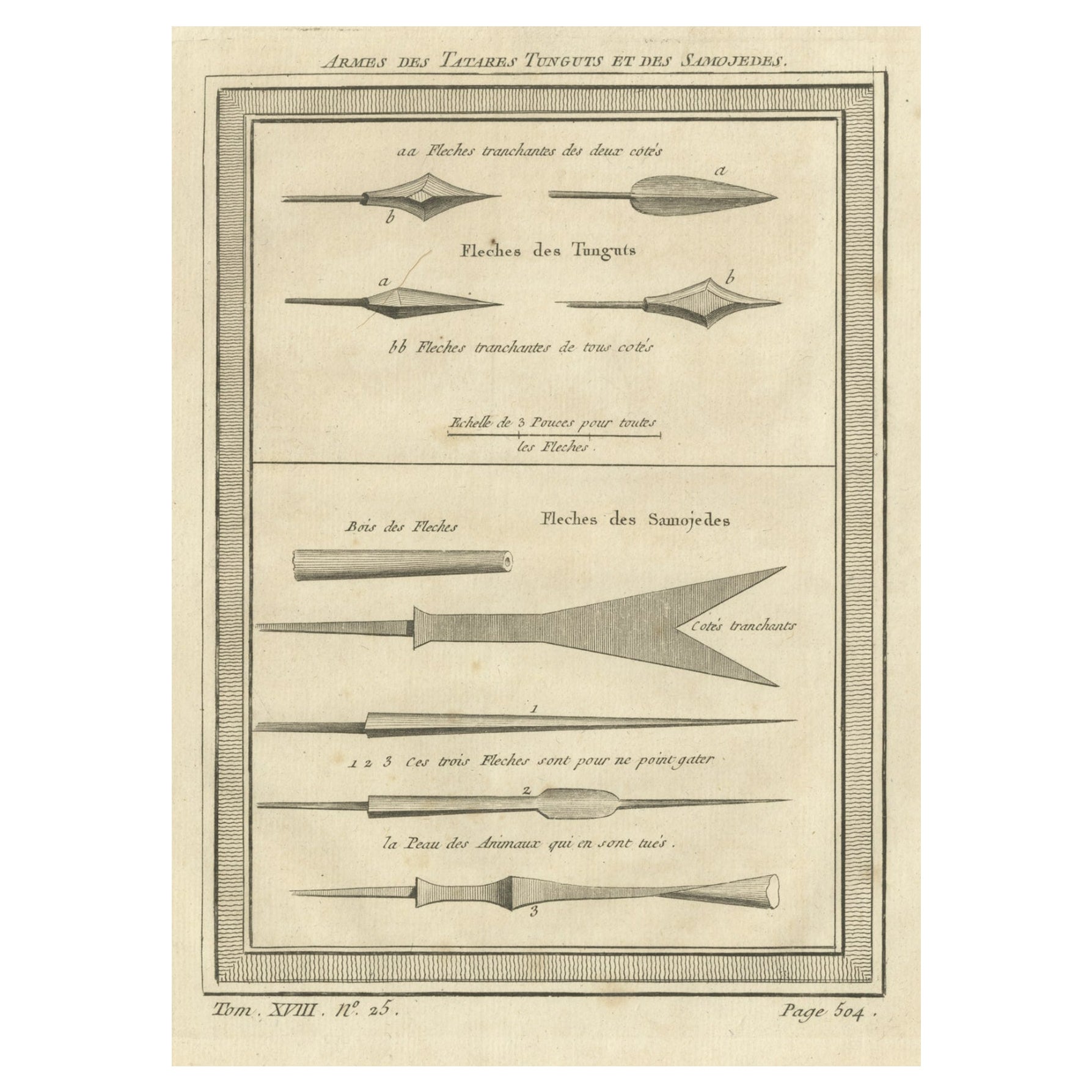
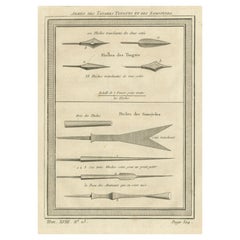
- Antique Print of Weapons of the Tartar Tanguts and the Samoyeds, 1768Located in Langweer, NLAntique print titled 'Armes des Tatares Tunguts et des Samojedes'. Copper engraving of weapons, like arrowheads, of the Tartar Tanguts and the Samoyeds. This print originates from vo...Category
Antique 18th Century Prints
MaterialsPaper
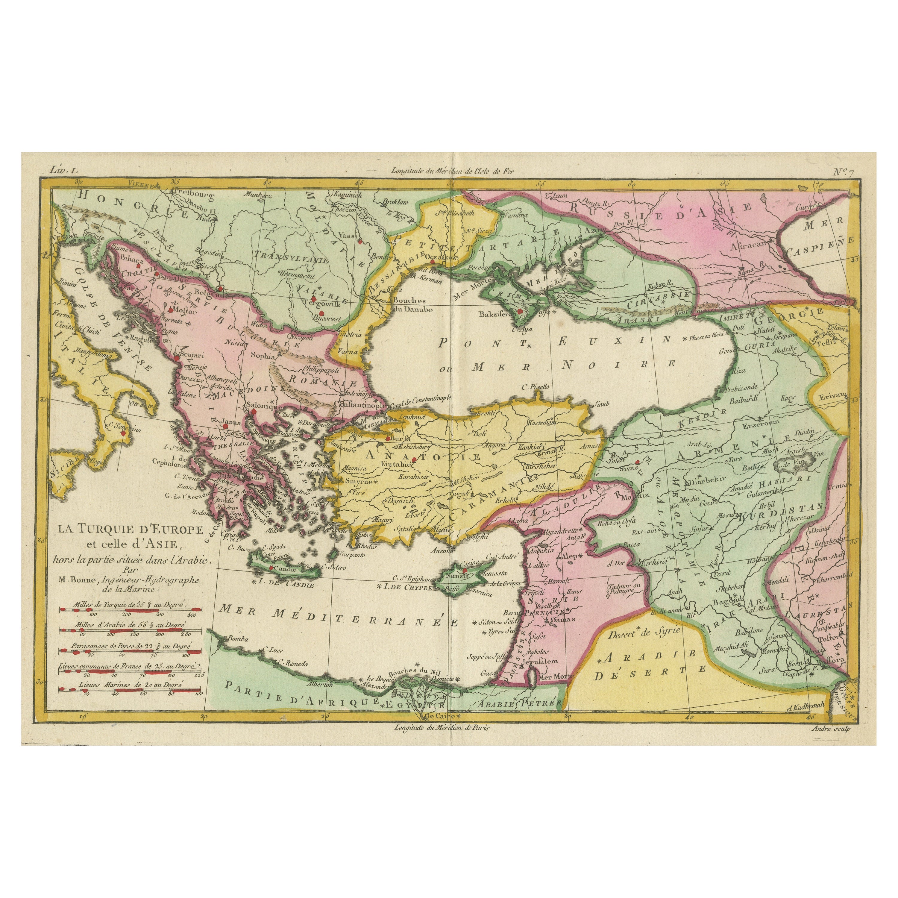
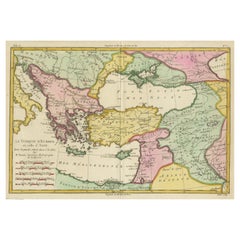
- Antique Map of the Eastern Mediterranean and the BalkansLocated in Langweer, NLAntique map titled 'La Turquie d'Europe et celle d'Asie'. Attractive double page map of the Eastern Mediterranean and the Balkans by R. Bonne. Originates from 'Atlas de Toutes les Pa...Category
Antique Late 18th Century Maps
MaterialsPaper
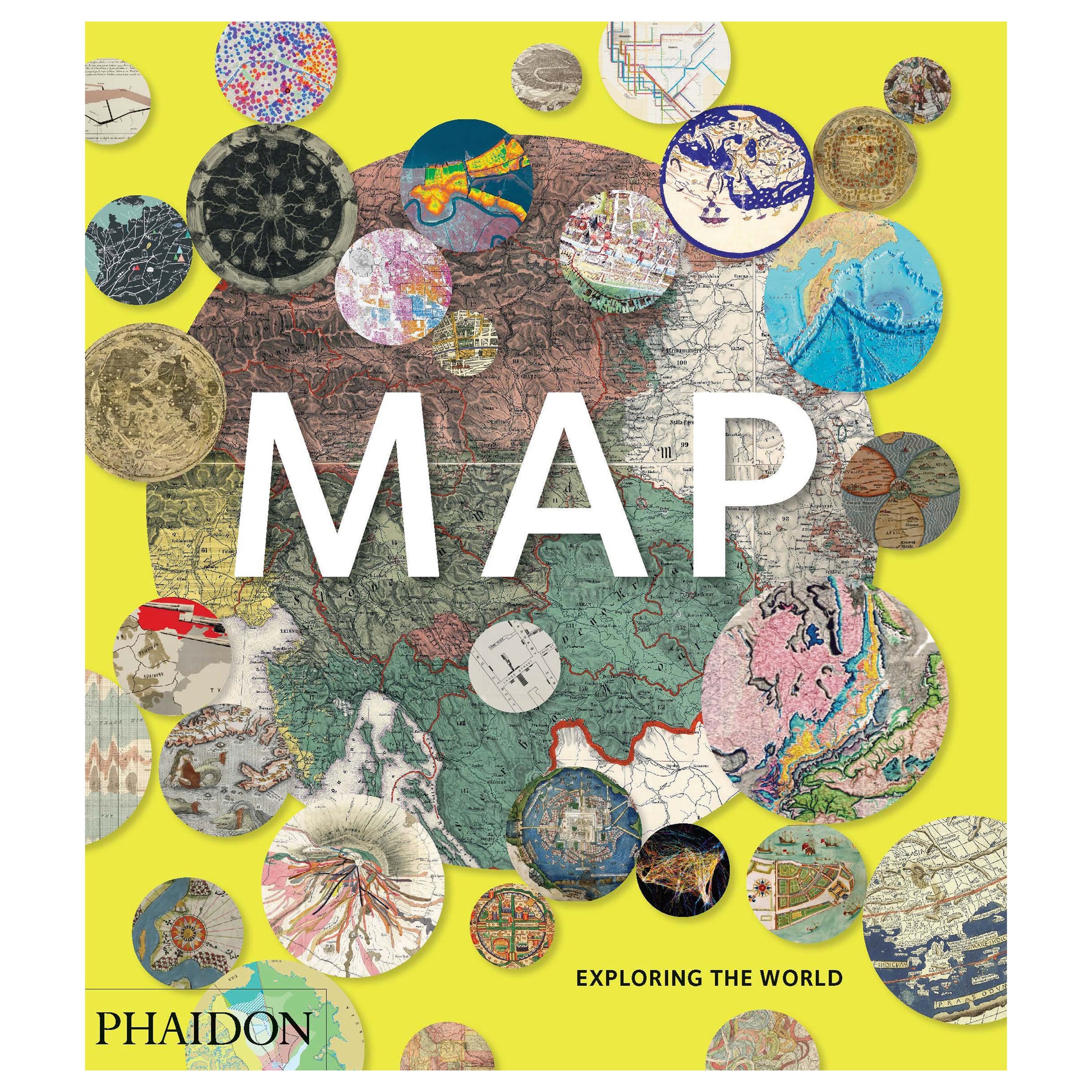
- Map, Exploring The WorldLocated in New York City, NY300 stunning maps from all periods and from all around the world, exploring and revealing what maps tell us about history and ourselves. Selected by an international panel of cartographers, academics, map dealers and collectors, the maps represent over 5,000 years of cartographic innovation drawing on a range of cultures and traditions. Comprehensive in scope, this book features all types of map from navigation and surveys to astronomical maps, satellite and digital maps, as well as works of art inspired by cartography. Unique curated sequence presents maps in thought-provoking juxtapositions for lively, stimulating reading. Features some of the most influential mapmakers and institutions in history, including Gerardus Mercator, Abraham Ortelius, Phyllis Pearson, Heinrich Berann...Category
21st Century and Contemporary Hong Kong Books
MaterialsPaper
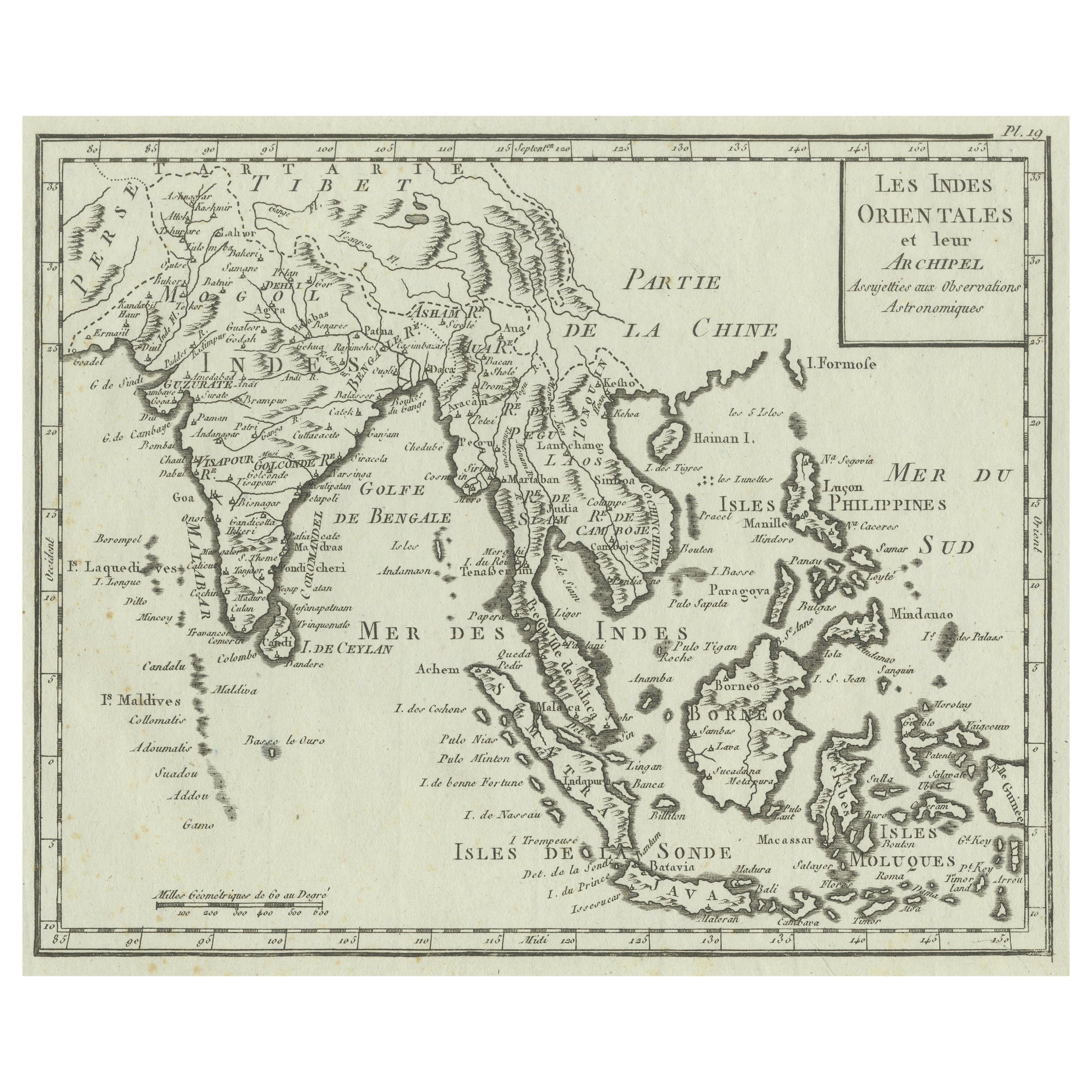
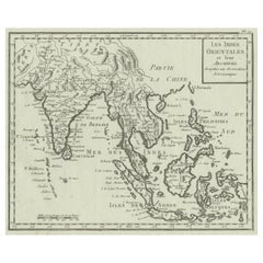
- Antique Map of India, the East Indies and the PhilippinesLocated in Langweer, NLAntique map titled 'Les Indes Orientales et leur Archipel'. Original antique map of India, the East Indies and the Philippines. Source unknown, to be determined. Published circa 1760.Category
Antique Mid-18th Century Maps
MaterialsPaper
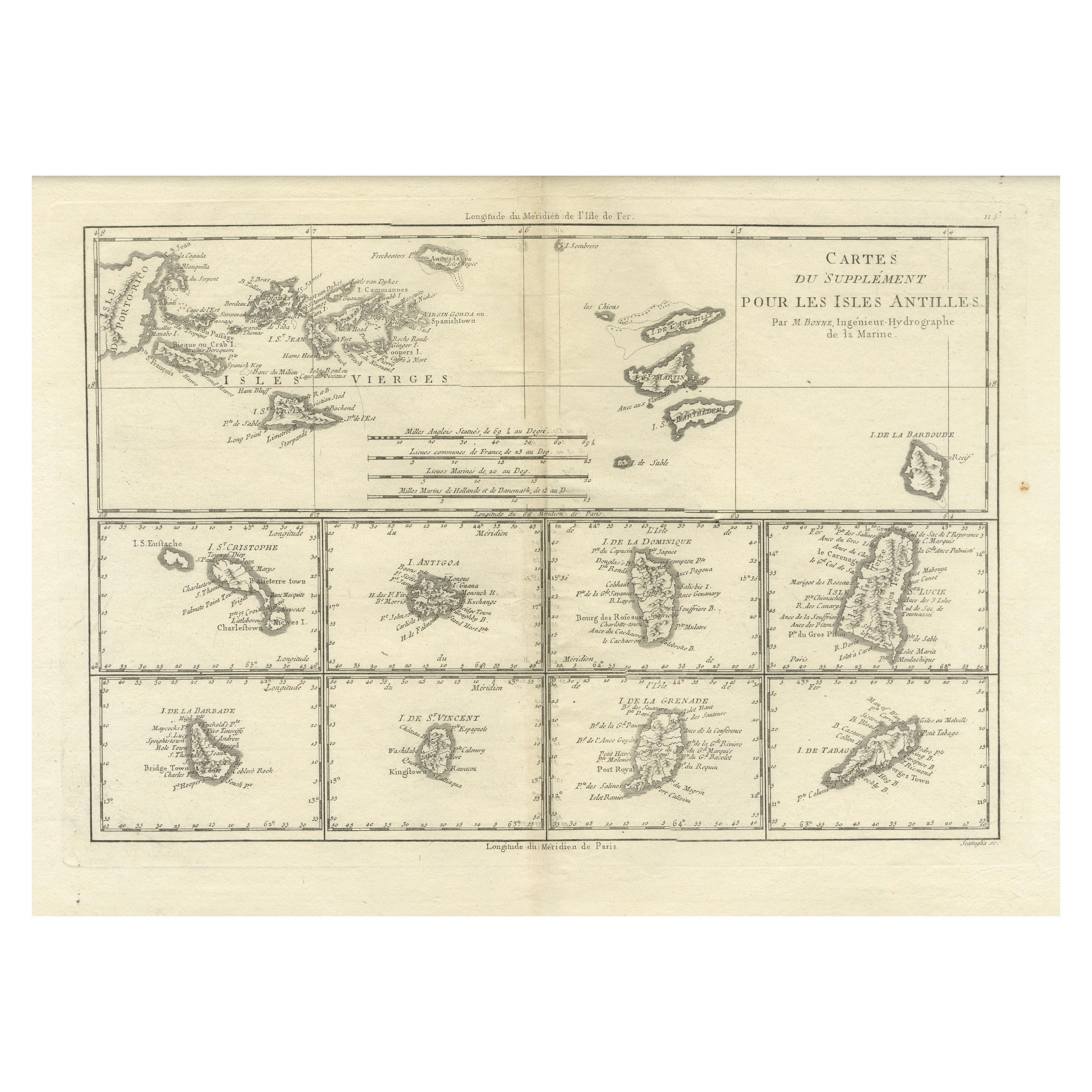
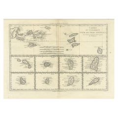
- 18th Century Antique Map of the Virgin Islands and Caribbean Inset MapsLocated in Langweer, NLA fascinating piece of cartographic history! The map, titled "Carte du supplément pour les Isles Antilles," featuring inset maps of various islands in the Caribbean, is from the "Atl...Category
Antique Late 18th Century Maps
MaterialsPaper
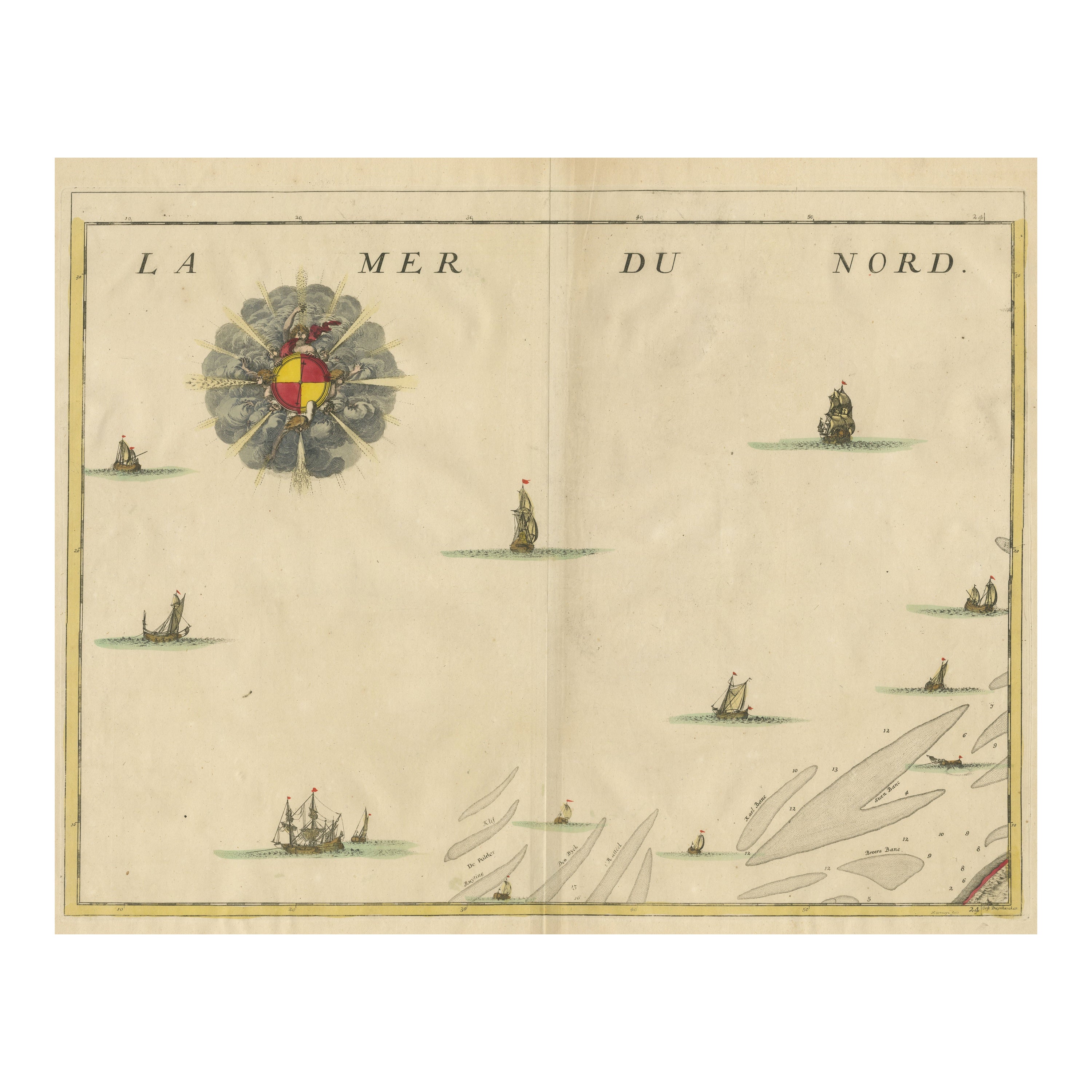
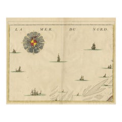
- Antique Map of the North Sea and DunkirkLocated in Langweer, NLUntitled map of the North Sea, top left a large compass rose, bottom right Dunkirk (Duinkerke / Dunkerque), France. Part of a bundled collection of plans of battles and cities renown...Category
Antique Early 18th Century Maps
MaterialsPaper

Recently Viewed
View AllMore Ways To Browse
Vintage Furniture Before And After
The Vintage Map
New Haven Vintage
R Thomas
World Map Vintage Map
World Map Vintage Maps
The World Map Vintage
Map Of World Vintage
Map Of The World Vintage
United States Map Vintage
United States Vintage Map
Vintage Map Of The United States
N Thomas
World Map Books
Columbus Vintage Furniture
Vintage Map Book
Map Columbus Used
Greenland Map